Managing Avalanche Risk Part 10: The Storm Slab Problem
Photo Credit: Colleen Gentemann
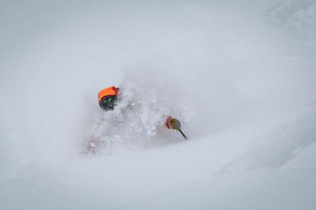
I love storm skiing. Most of my epic powder days have been storm days—albeit calm storm days.
That said, storm slabs can be tricky. They often don’t feel “slabby” and can ski like great powder. Signs of instability can be subtle and easily missed, and the change from stability to instability tends to occur quickly with little warning. Storm slab avalanches can be huge, involving entire start zones and extending to or even beyond historical path boundaries—not something you want to mess with.
Here’s a story about guiding a storm skiing day at Monashee Powder Snowcats in B.C. that progressed from “this is all-time” to “now it’s home-time” that we managed without incident.
When guiding, I’m up at 5 a.m. and the first thing I do is go outside to see what’s going on with the weather. On this day, I estimated 35 cm of new snow, all of which had fallen after 10 p.m., meaning the average snowfall rate would have been 5 cm/hour for seven hours. It was still snowing heavily, and the snow on the ground felt light and dry.
At our weather plot where we make readings twice a day, we observed 38 cm of overnight snow with a water equivalent of 20 mm and a density of 52 kg/m3. It was snowing at a rate of 4 cm/hour, the temperature was -6 degrees C, and there was no wind.
Nearly 40 cm of new snow in less than 12 hours and a precipitation rate of 4-5 cm/hour are red flags for storm slab development. On the other hand, we had some factors going for us. There were no crusts or weak grains at the old surface or in the snowpack. Nearby upper-level weather stations showed very little wind overnight, and the storm’s air temperature profile looked good, starting at -3 degrees C around the time the snow began and gradually cooling off. The snowflakes falling out of the sky were big, soft, and fluffy.
In our morning hazard nowcast, we felt the positive factors in the morning observations outweighed the two red flags and our theory was that storm slabs had not yet formed as of 7 a.m. The day’s weather forecast predicted temps steady around -5 degrees C, light and variable ridge-top winds, and precipitation all day at hourly rates of 2-3 mm of water.
In most technical forecasts, precipitation rates and accumulations are shown in millimeters of water. Most public forecasts that show snowfall amounts in centimeters assume 1 mm of water will result in 10 mm (1 cm) of snow, a water to snow ratio of 1:10. In the U.S., the snow water equivalent of a 1:10 ratio is often referred to as 10 percent, while in Canada we’d say the snow density is 100 kg/m3. While 10 percent water doesn’t seem like a lot, it’s actually pretty heavy by powder skiing standards—more like coastal powder rather than Rocky Mountain cold smoke, which is usually 3-4 percent or 30-40 kg/m3. In B.C.’s Columbia Mountains, we do get both heavier snow and super low density new snow at times but the typical, classic, perfect pow day here runs around 5-6 percent water equivalent or 50-60 kg/m3. So the 1:10 rule may be valid at valley bottom, in warm climates, or in spring, but it generally doesn’t hold up in colder temperatures or at higher elevations.
In our 6 a.m. morning observation, 20 mm of water overnight had produced 38 cm of snow, so our water to snow ratio was closer to 1:20, meaning a snow water equivalent of 5.2 percent, or a density of 52 kg/m3. So, for our hazard analysis we guesstimated the 2-3 mm/hour of water in the weather forecast would create 4-6 cm of snow per hour at our location. If that kept up all day, then by 4 p.m. we’d expect another 40-60 cm of accumulation in addition to the 38 we’d already had.
“All reports confirmed everything looked good. So, we did what anyone who loves powder skiing and is confident in the snowpack would do—we went for it. “
Welcome to the Monashee Mountains! But even by Monashee standards 80-100 cm in less than 24 hours is a lot of snow, and we predicted that, even if no other negative factors (i.e. increasing temps, higher winds) came into play, storm slab problems would show up at some point—likely in the afternoon. We thought we had a few hours before things became unstable, so our run list had a lot of green on it with the caveat we’d have to turn much of it red at some point. We also added a note reminding us to constantly validate our forecast and reassess our plans so we wouldn’t get caught by surprise if the tipping point came earlier than expected.
By the time we rolled out of the yard at 8:30 a.m., another 10 cm had fallen, and everyone’s fun meters were maxing out in anticipation of an epic day.
I took some flack on the first couple of runs as I started on conservative terrain, testing small steep “indicator” features where I knew this was where problems would show up first. I held people back as I ski cut small convex rolls looking for early signs of instability but saw nothing of concern. Radio calls between guides reported observations and discussed how we were feeling as we eased into the day. As lead guide, I was also in touch with our snow safety team and the road maintenance snowcat driver. All reports confirmed everything looked good. So, we did what anyone who loves powder skiing and is confident in the snowpack would do—we went for it.
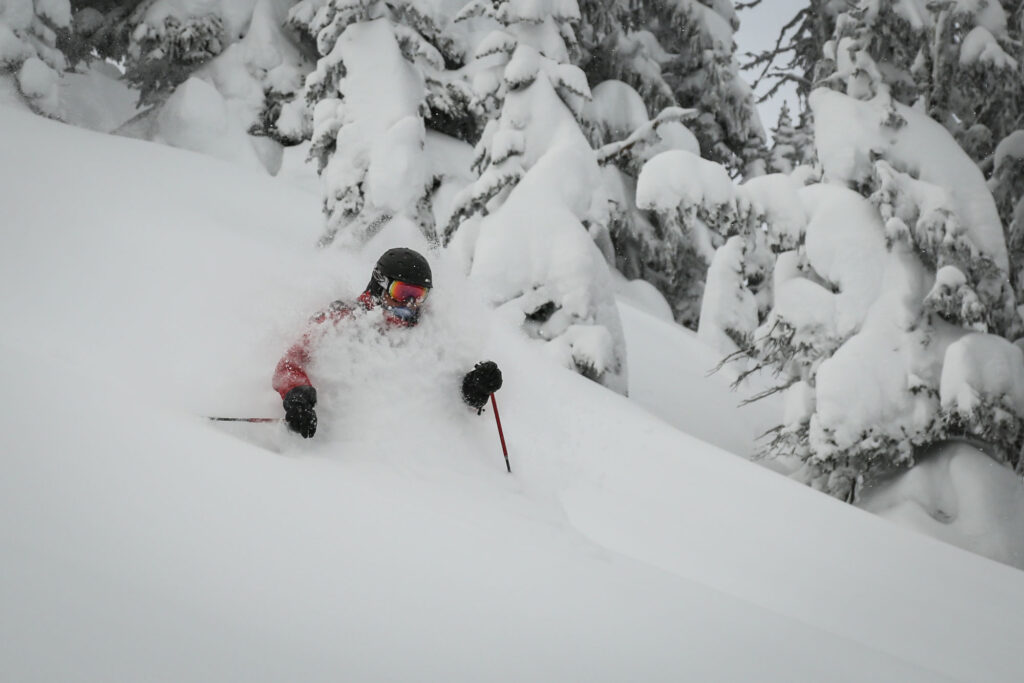
It was glorious. Thigh deep pow. Face shots. Screaming, happy, laughing people. The kind of day you talk about for the rest of the season and remember forever. Then, around 10 a.m., there was a subtle, short duration change in the nature of the snow falling from the sky.
“Snowflake” is not a technical term, it’s a colloquial word used to describe a number of smaller, interlocked crystals that form a multi-crystal raft floating down from the sky. The big snowflakes I mentioned earlier were made up of interlocked stellar dendrites, which are the classic six-armed, opaque, white snow crystals we all think of when we talk about snow. Assuming the bond at the old snow surface is decent, these interlocked crystals generally result in relatively stable new snow.
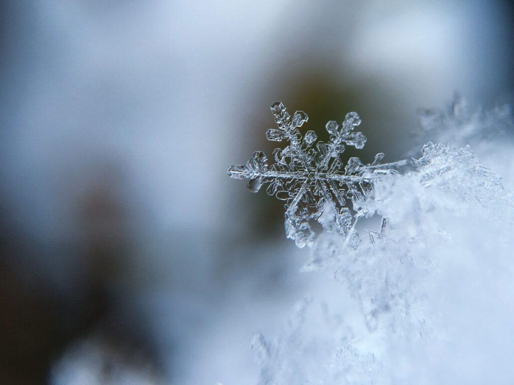
But snow comes in many forms, and at around 10 a.m., the crystals we saw falling from the sky changed to plates, which are filled-in, icy-looking, clear hexagon shapes. Plates don’t interlock like stellars, so they tend to not hold together as well. So, at this point we had a thick layer of reasonably interlocked stellar dendrites well bonded to the old surface with less cohesive plate crystals lying on top. When something like this happens, the question is: How long do the plate crystals keep coming and what happens next? In this case, after about 20 minutes, something changed again, and we were back to the bigger more interlocked flakes of stellar dendrites. But now we knew we had a potential discontinuity in the storm snow, even though it was only a few millimeters thick and invisible to the naked eye once buried.
It continued to pound snow, but with no results from ongoing testing we skied pretty aggressively until early afternoon. Then, shortly after lunch, the clouds thinned a bit and the air temperature rose slightly. We were skiing south aspects, so even though the solar radiation was filtered by clouds, I didn’t need my thermometer to tell what was happening. I could feel the sun and stripped off a layer because I was suddenly too warm. And I sensed a change in the snow—what had been blower powder was feeling ever so slightly upside down. Now, when this happens and you’re in 20 cm of storm snow, you might not be too concerned right away, especially if you’re skiing moderate terrain. But by this point we had seen something like 75 cm of new snow in just over 18 hours, and we were skiing steep terrain. In this scenario, it doesn’t take much to tip the balance from great skiing to great avalanche conditions. Our morning avalanche forecast had predicted an afternoon change, and our risk management plan reminded us to be vigilant, so I was primed to revalidate our forecast and reassess our plan.
“Almost immediately, they reported significant dry loose snow avalanches. And the tree wells were huge.”
As part of the validation process, I talked to the other group who was seeing the same thing. But the snow safety team and road maintenance cat operator, who were on north-facing slopes, reported no change. With that information, we decided to move the ski program to north aspects. In helicopter or snowcat skiing, or with snowmobiles for access, moving your program to a completely different area is relatively easy. However, this might not be so simple in touring scenarios, and you might need to take a different approach—going to one of your more conservative backup plans for example.
On the north side, to hedge my bets, I rechecked conditions on a moderate run. Things felt OK but visibility was much worse than what we’d had on the southerly slopes. I consulted with my team, and we agreed to ski lower elevation tree runs where we’d have better reference and maybe a bit less new snow on that plate layer. But now, with close to 80 cm of storm snow, we were acutely aware the storm slab clock was ticking, even in the trees.
I told group No. 2 to skip the easy run I was on and go straight to a steeper tree run. Almost immediately, they reported significant dry loose snow avalanches. And the tree wells were huge. This prompted us to make sure everyone was up to speed on safe tree-skiing protocols: Slow down and plan your turns in advance to avoid trees, tree wells, gullies, and other terrain traps. I reminded folks to shout out and use their radio to call for help if they lost sight of their partner for more than a few seconds. And we used sluff management techniques: Don’t ski directly above someone else; ski a slightly diagonal line so loose avalanches run beside or away from you instead of following you down the fall line; and if you see snow moving around you, pull off to the side and stop, let sluffs run past you, then continue your run.
Skiing shorter pitches and regrouping more often, we had a few great safe runs in the trees. Then, suddenly, the snowpack went berserk. It was like someone flipped a switch and the pack was suddenly energized. We first saw this as every cutbank fractured and avalanched onto the roadbed when we approached in the cat. Even though there was no significant change in how the snow felt under our skis and no overt signs of a slab, in the course of a 15-minute lap we went from great skiing to soft storm slabs running on everything we touched that was over 30 degrees. These slabs were starting on the plate layer we’d observed earlier in the day, but once running they entrained most of the storm snow and, even though they were not propagating widely, we definitely didn’t want to get mixed up in them, especially where someone might get pushed into a tree well or smashed into a tree.
Around this time, the snow safety team called in and reported hearing a large avalanche in the area where they were working. They couldn’t see anything because of weather and visibility, but this was a clear indication we were at the start of a natural avalanche cycle that was likely to involve large slides widespread over all aspects and elevations.
“Then, suddenly, the snowpack went berserk. It was like someone flipped a switch and the pack was suddenly energized. “
Even though it involved some plowing, we finished our day with a couple of runs on gentle, planar slopes with no terrain traps, no start zones above us, and no avalanche paths around us.
By dinner time that night, the storm eased off, and the next morning we noted storm snow height had decreased even though there had been a few centimetres of new snow overnight. This is called settlement, and it’s caused by snow crystals, in this case the stellar dendrites, breaking down into smaller pieces, which reduces the pore space between grains. As a result, the snow height decreases and density increases, and what had been thigh- to waist-deep powder yesterday became just over knee deep. We saw that many avalanches happened everywhere overnight during the natural cycle but by the time we got out there natural activity had stopped. But we were able to trigger soft slabs on steep terrain while skiing on the day after the storm, so we took a more conservative approach than on the previous day. This is not uncommon—as that settlement occurs and the snow gets denser, the snow grains bond together and form a firmer slab that’s a bit harder to trigger but propagates readily if initiated.
This condition settled out and tightened up later in the day—a typical 36-hour storm slab cycle that ends when the new snow stabilizes as it becomes more uniform and discontinuities amalgamate due to settlement and bonding.
Then, a day later, the wind started blowing, and we ended up with a post-storm wind slab avalanche problem, which we’ll discuss in Part 11.
Karl Klassen took his first professional avalanche course in 1979 and spent the next 40 years working as a forecaster, guide, educator, and mentoring up and coming forecasters and guides. During that time he also sat on the Association of Canadian Mountain Guides board of directors including serving as vice president, president, then as executive director. He joined Avalanche Canada in 2004 as a public avalanche forecaster and became the warning service manager in 2009. Recently retired, he lives in Revelstoke, B.C., where he spends his time cycling in the summer and skiing in the winter.
Support The Powder Cloud
The Powder Cloud is dedicated to providing you the education and mentorship required to travel safely and find the happiness in the backcountry.
We’d like to ask for your support—for our scrappy editorial team, our wise and experienced contributors and to help us develop new and creative ways to educate all backcountry skiers and riders.
If you are able, please consider supporting us. Thank you and we appreciate you.
Related Posts
Loading...