How To Explore New Places
Where are we going this year?
It’s October, ski season is just around the corner, and you are already planning a getaway with your ski touring partners. “Where are we going this year?” has become your annual mantra. You love to visit new places, and the options are endless. Somewhere in Iceland? Somewhere in Norway? Somewhere in Canada? But underlying the dream, one thought nags. None of you has been there, and how are you going to know where to tour? How can you optimize your trip and not get bogged down by a crappy tour on bad snow in bad weather?
This article isn’t about which destination you should choose, nor is it a travel guide to anywhere. But it is, in some ways, a travel guide to everywhere, as it outlines strategies that I use to safely guide my friends and clients in unfamiliar mountainous terrain. I have guided in far-flung places all over the world, and I hope my experience can help make your next trip better and safer.

What do I need to know?
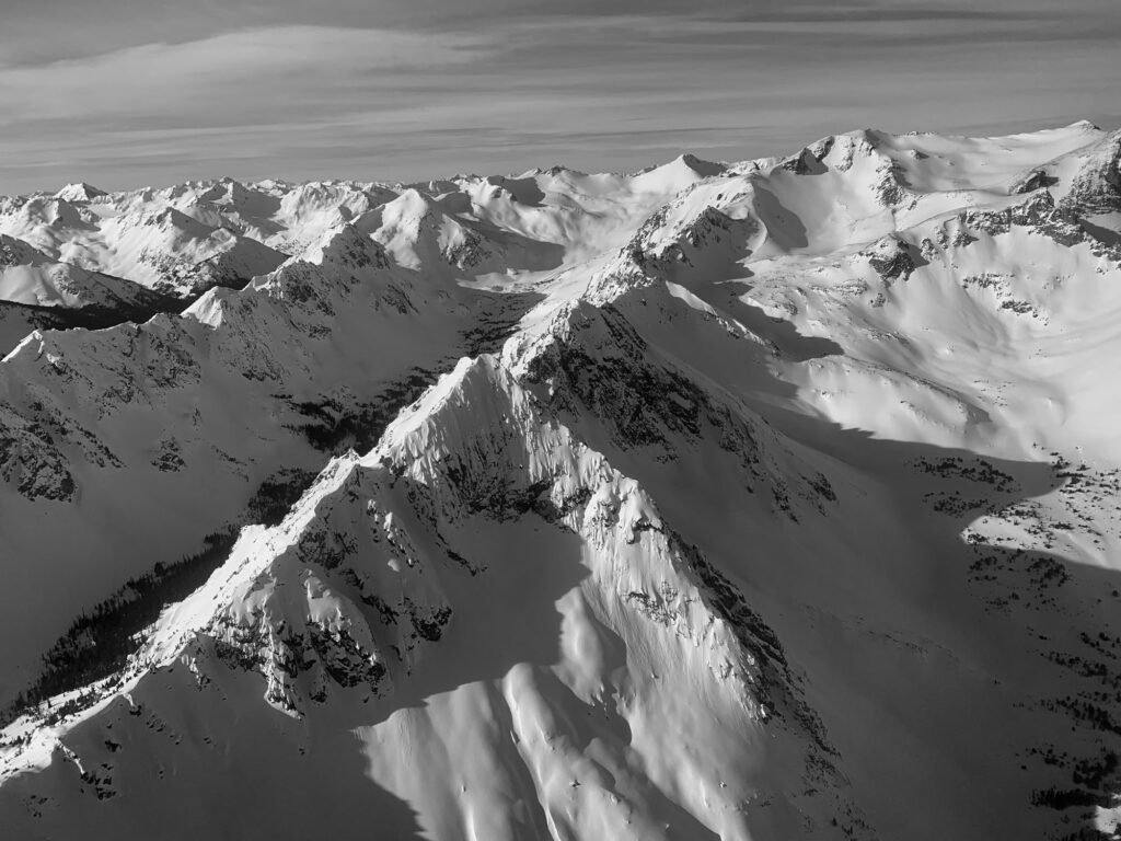
Before I start asking a local about where I should tour in a new place, I familiarize myself with the shape of the terrain to help me anticipate both route-finding challenges and typical avalanche problem types. I want to see the big picture first. Are the mountains rugged, granite peaks with hanging alpine valleys and narrow drainages like the Selkirks? Or are they old, eroded mountains with high-elevation craggy ridges like the Rockies? Or are the peaks heavily glaciated, like in Alaska or the Coastal Mountains, with broad glacial valleys and steep lateral moraines? I also learn the place names of peaks, drainages, and mountain slopes, which helps me imagine the area in 3D. Then I compare similar, familiar regions to help me identify a quality zone where I can plan options, including safer routes, peak ascents, and fun descent lines.
Next, I identify the local snow climate and the associated typical avalanche problems and match it to the terrain. This gives me a good idea of the types of hazards I will be dealing with so I can generate a general-terrain use mindset prior to learning home. Is it a continental climate typified by cool weather, a shallower snowpack, and persistent avalanche problems? Or is it a maritime snow climate with heavy precipitation, frequent ridgetop rain events, cornices, buried rain crusts, and wind slab problems? Or is it something in between? This helps me understand what to look for in the snowpack when I’m there and what types of terrain I might want to avoid.
Say, for example, I’m going to the Rockies in mid-winter. I know its steep, craggy terrain and shallow snowpack is a recipe for a basal weak layer like depth hoar, so I know I will need to use a long arm of caution when choosing to ski under big slopes or center-punch lines below summits. (I also know that if I brought my Valdez steep-skiing mindset to this trip, I’d likely not make it home.) If I’m going to Iceland, on the other hand, I’m expecting broad, uniform, rounded but steep slopes rising out of the ocean in what is an Arctic maritime snow climate. I’m expecting deep and dense snow, a strong wind effect, frequent rains to the top of the peak, ferocious storms, and snow that stabilizes fairly quickly after the storm eases. This adds up to a dense and fairly stable snowpack with lots of crust layers, which leads to superb corn skiing when the sun comes out.
Regarding timing, I try to target the optimal part of the winter when the ski conditions might be ideal. I find out whether my group prefers longer, warmer days and spring conditions or shorter, cooler days with a chance of better snow. I also try to avoid local holidays and long weekends to minimize cost, crowds, and travel hassles.
Importantly, I research classic ski tours in the area and try to imagine what makes them popular, and then I outline the logistics required to pull it all together. I think about where I would go for a full-day or a half-day route. I include several bad-weather options. I hunt down quality loops where I can enter and exit via different drainages and see more terrain.
Then I decide what specific gear is required for each tour, including an emergency satellite device, ski crampons, ice axe, glacier travel gear, overnight gear, etc. And finally, I try to nail down the location and logistics of departure points. Where should we park? Do I need an additional vehicle to pull off a car shuttle? What about using a helicopter bump into the terrain to avoid the 12 km, 1200 m vertical climb? What about permits?
How do I find this out?
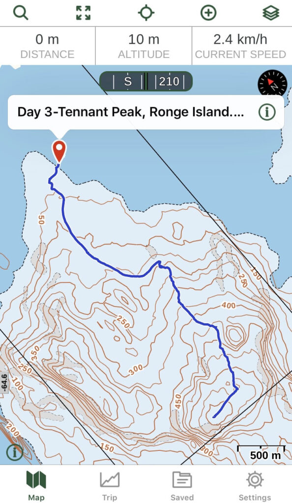
Topographical paper maps and CalTopo or GaiaGPS digital maps are all great sources of information and work well for trip-planning. For popular touring destinations, there will be plenty of digital maps and/or guidebooks with annotated ski routes. For places off the beaten track, online satellite image sources like Google Earth or Fatmap are useful for exploring in a simulated 3D and looking at the terrain from different perspectives
Another great place to start is with the local guiding company websites. Identify which trips are offered and when they go. Often the guides will blog about “secret stashes” with photos to attract clients. This can provide insights into a new area.
But the best way to preview terrain is to talk with a local who is well-informed. Before you start asking questions, do your research so you can visualize the terrain, name the spots, know where folks go, and then listen, and understand how the person sees the terrain and the hazards and why they stay away from certain routes and/or slopes. Alternatively, if it’s in your budget, just sign up for a guided ski tour and gain insights on current conditions from a local pro.
Biggest hurdle
The problem with depending on local beta is knowing whether your source is reliable. (While a lot of guides books are lame, the good ones are both reliable and popular because they are well-researched.) Not every local is skilled at communicating route information. Not every local can set a good track and embark on the right tour on the right day. The local might think they are being helpful but might not divulge what you need to direct you toward the best option. And online trip forums? They may have a few helpful terrain photos to download, but in terms of actual beta, do you have the time or knowledge to separate the diamond from the drivel?
When in a new area for the first time
When guiding for the first time in a new area, there are days when, even when I arrive prepared, I still feel like a calf with fresh legs. But I’ve got a strategy that usually works.
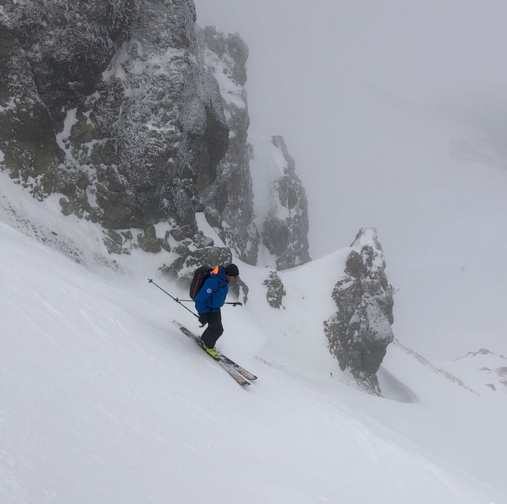
On the first day, I apply a “check it out” mindset (read “Know Where Not To Go” for more on this topic) and head out on what I like to call an “indicator run.” This approach allows me to step carefully into a new drainage onto a run that is representative of the area we will be touring in, and also provides safe, fun skiing. It’s a great first look. Especially with good weather, our indicator tour gives us a chance to look around for recent avalanches, wind redistribution of snow, and cornice formation; and to dig down to the layer of concern as outlined in the backcountry forecast. Importantly, that first tour gives us a chance to gain the lay of the land before committing to more exposed routes. The first trip also serves a dual purpose as a shake-down tour, ensuring that the gang has survived their travel lag and the gear is working. Here are some objectives of the check-it-out tour:
- Note existing trails and tracks. Discuss where people are going, and what terrain they seem to deliberately avoid.
- Check out accesses, passes, ridges, and other terrain features that naturally provide safer routes through the terrain.
- Scope out lines from the other side of the valley and remember up-tracks and quality downhill routes.
- When the weather is good, take as many photos as you can of the terrain. Those images can be a key aid when route-finding later in poor light.
Remember
The key to quality route selection is recognizing terrain and terrain use patterns. The more you study established routes through different types of terrain and the changing snowpack that overlies that terrain, the easier it is to anticipate what constitutes a fantastic tour.
Traveling to new places keeps us excited. And when we apply the above strategy as a pre-travel checklist, the more likely the trip will be fun, safer, and unfold with a nice successful flow.
Colin Zacharias is a consultant and educator in the avalanche and mountain guiding industries, and an IFMGA/ACMG mountain guide. He resides on Vancouver Island.