
La Niña Advisory Issued for the Winter
On September 10, the National Oceanic and Atmospheric Administration (NOAA) officially issued a La Niña Advisory that states there’s 75% chance La Niña will continue for the winter.
Throughout the summer, we monitored NOAA and the World Meteorological Organization’s El Niño Southern Oscillation (ENSO) forecasts for the coming winter. In August, surface and sub-surface temperatures in the tropical Pacific were trending towards below average. The cooling continued, reaching La Niña levels during September.
The climate prediction center looks for three things before they will issue a La Niña advisory:
1. Sea surface temperatures in a particular region of the equatorial Pacific, called Niño 3.4, must be cooler than long-term averages. Specifically, they look for consistent readings of equal to or less than -0.5° C difference form the long-term averages. Currently, their data sets have it at -0.6° C.
2. They use computer modeling to understand if it will remain more than 0.5° C cooler; currently, the modeling predicts it will.
3. They also look to see if the atmosphere is showing signs of a response to the cooler-than-average temperatures. Primarily this is a strengthening of the Walker Circulation, an ocean-based system of air circulation, which they are currently observing.
However, I want to be clear that while ENSO is one of the most well-known seasonal pattern drivers and should not be overlooked, it is not the only one. Our atmosphere is extremely complex, and there are many factors in the atmosphere and oceans (including additional oscillations and temperature anomalies) that can impact our weather patterns in the winter. Some of these factors can only be forecasted with reasonable accuracy, about two weeks in advance.
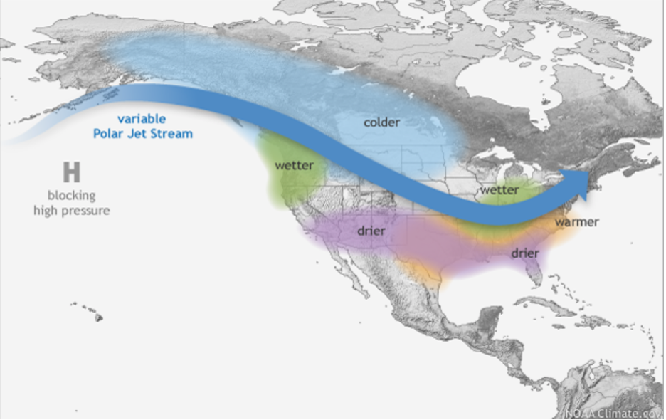
What will the winter be like? Well, this is where it gets tricky. Every ENSO event and winter is different. However, a La Niña can make some outcomes more likely. Winters in the Southern U.S. can be warmer and dryer, while the Northern U.S. and Canada tend to be colder. The Northwest U.S. and British Columbia could see a wetter than average winter.
Stay tuned. In October and November, a few daring climatologists will provide forecasts for this particular La Niña, even though this is extremely difficult task. We’ll keep you updated as those become available.